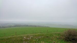
Sometimes you ride under a cloud less sky, sometimes under a blanket of white. Sometimes a ride takes place inside a cloud. This was to be one of those rides
Head up
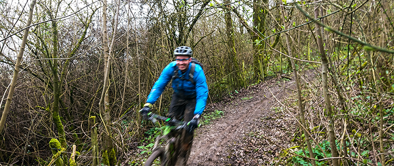
One of the fundamental tenets of good trail riding is to keep your head up. It’s also a tenet of good navigation. The more you keep your head up, the further ahead you can see, the better you can prepare for what’s coming, the more in control you are when it arrives. The further along the trail you look for that difficult-to-spot right turn, the greater your chances of seeing it before you go past. The only problem with this approach is when you’re riding through low cloud and can only see a few yards in any direction. That is the situation we found ourselves in on this ride for a considerable time.
It’s made worse by the navigational black hole that plantation woodland offers. Even the beechwoods mean that, just because something is marked on the map as a significant track, doesn’t mean that is exists on the ground. More confusing is that the broad track in front of you may not appear at all. That’s why we took the scenic route off the ridge line. It definitely wasn’t that we missed the right turn. That’s not what happened at all. Having said that, the route we did take was lovely as was the scenery that we could see.
Clouded judgement
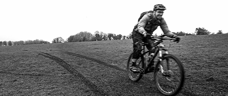
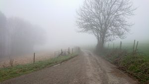
Clark and I found ourselves out in the South Downs near Cocking (no laughing at the back) on a Tuesday morning in April in the name of a ride recce. There was a window in our diaries, and we went for it regardless of whether there was a window in the weather. The forecast was for intermittent drizzle all day, so we prepared to get damp. Better yet, it had rained persistently for days before the ride, which can play havoc with trails in this part of the world. So, we were prepared to come back to the car filthy as well as wet.
What I hadn’t expected in the South Downs was for a goodly chunk of the day to be above the cloud base. However, it wasn’t actually raining so we decided to get on with the lesser of two evils.
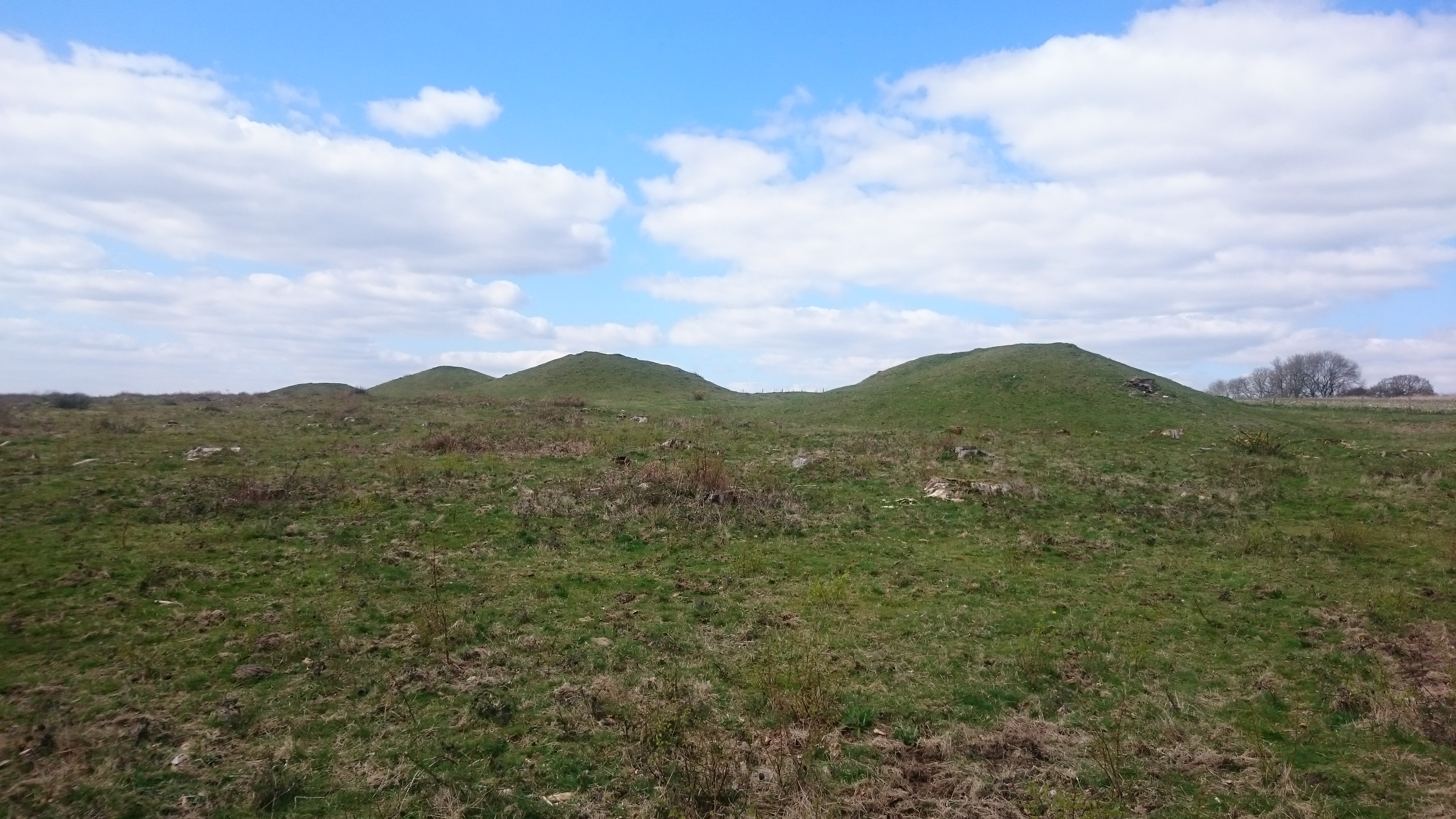
The first track was a pretty unremarkable track, except the farmhouse with the canary yellow UPVC windows. It’s a relatively easy way to gain a fair bit of height and the price you pay for a downhill finish. As it levelled off we found ourselves surrounded by some brilliant archaeology in a landscape littered with cross dykes and round barrows reminding us that people have been living and working in this landscape for a very long time. The views out across the scarp face towards the Weald. Or, at least we should have.
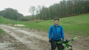
Cocking: there’s a view out there somewhere
Instead of the archaeology and the vista we were treated to the atmospheric tendrils of cloud wrapping themselves around us, obscuring anything more than a few metres away. Instead, Clark had to content himself with my colourful descriptions of what he should be able to see. I can spin a pretty good yarn, but there are only so many synonyms for “massive” that I could think of whilst avoiding the potholes and quagmires that presented themselves. Oh, and keeping an eye out for that elusive right turn.
The lively discussion of the Bronze Age landscape might explain why it took longer than expected to arrive at that right turn.
Head down, eyes up
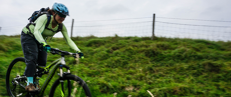
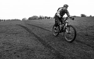
Gently downhill duplex in the summer can be a ticket to light-speed on a bike. In early April after the wettest winter in recent memory it was a little different. We still whipped along at a fair lick but found ourselves having to time manuals well so as not to lose front wheels in opaque puddles or piles of sodden leaves. Closing my eyes occasionally helped keep the grit out of them.
I had a clear memory that there were a couple of slightly tricky junctions from a navigation point of view, you know the ones where two trails run off almost parallel where the map says there should only be one. So, I was keeping my wits about me for these choices approaching at speed, through the cloud and the spray of my front wheel.
Which is why I was more than a little surprised when the trail ended abruptly at a gate into a field. This was not right. This was definitely not where I had anticipated ending up. I thought we had gone a long the ridge for longer than anticipated. This gate confirmed that we were not where we were meant to be. The problem with missing your turning is that it can be hard to work out at what point you have deviated from the plan. A perusal of the map revealed that we had simply missed the turn and taken a path that ran parallel to our original plan. After a quick recalibration, a new route down was hatched that went through the gate ahead and joined up with the route as planned at the bottom.
Initially, I was disappointed. The descent to the combe floor was a grassy field. No fun in that. Still, make what you can of it. I kicked off and set off down the hill, very quickly picking up enough speed that washing out on the sopping grass became a realistic hazard. Stay loose, stay relaxed, trust your grip on the off-camber hillside. The problem with descents like this is that there’s very little calibrate your speed against. Ahead of me was a lynchet, it was approaching at warp speed, and the sharp break in slope meant that the crest was entirely blind. I had no idea what was on the downslope. Attack position. Commit.
It was relatively steep but nothing terrifying, granting plenty more speed. The bottom was a sharp enough trough that it needed a manual to get through smoothly. The horrible buzzing sound of rear wheel on mudguard confirmed that the rear suspension had absorbed considerable compression. Head up, look for the next one. Approaching even faster, this was much more fun than I was expecting. A few more lynchets between me and the bottom were despatched with increasing velocity before the reality of the rapidly approaching fence at the bottom of the hill made braking a priority. Clark appeared, grinning like a loon. For an accidental descent, this one was a keeper.
The archaeology is exciting, but can we do some riding now?
“So, are they barrows?” he asked
“No, these are lynchets” and proceeded to explain what lynchets are. To save you having to listen to me explain it as well: here’s a link.
The particular lynchets we were looking at turned out to be relics of a Bronze Age field system that, until recently was thought to be lost. This relic is a scheduled monument that, until recently, was thought to be the only remnant in the area. A LiDAR (follow the link) survey showed that the whole ridge here is covered in Bronze Age fields. We archaeologist are still very excited about it.
Clark was less impressed, so we rode on.
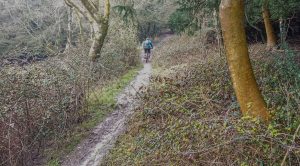
Going the wrong way
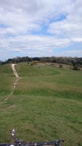
The difficulty in planning rides in this area (and to be fair most areas) is which way round to do it. If you’re riding a loop then, for every cracking descent, there’s going to be a climb. For every climb someone will tell you that you should be riding down it. The next climb was very much one of those. Maybe on a drier day it would have been rideable, but not today. I know why the ride is planned this way around, and this was something of an experiment. That didn’t change the fact that we were off and pushing up the kind of steep, sinuous woodland singletrack that people would bite your arm off to ride. We were definitely doing it the wrong way, and we seemed to be doing it the wrong way for quite some time. There has got to be a way of doing it the other way. This is one for the OS map, later.
On the up side, we seemed to have dropped out of the clouds. But it was still sweaty work, gaining considerable height ready for another descent. At the top there was a longish, straight tarmac transfer to our next point of interest, so time to get our heads down and make up for some lost time. It wasn’t quite a team time trial, but we weren’t hanging about. Straight past Goodwood racecourse and on to something that, for me at least, was far more impressive.
Trundling along
The Trundle, and Chalkpits Lane, in particular, holds a certain significance in the history of mountain biking in this area. Many of the bridleways that drop off this hill were within the reach of early mountain bikes and were something of a Mecca in the 90s. But that’s only the most recent episode in a long history of significance to this hilltop. As far back as the Neolithic, people were building things here. Many of them can still be seen. I get very excited about these things. I explained what a causewayed enclosure is, stating that the banks probably looked more impressive but they’re quite old.
I can see the sea from here. Normally
Clark was impressed too: “are they old then?”
“About 5,000 years old.”
“Wow.”
This Neolithic site sits squarely in the middle of an Iron Age hillfort with an impressive bank round the outside. What makes for a strong defensive feature also makes for an excellent spot to have lunch. The view from here is spectacular. Given that it was all ensconced in cloud, Clark had to make do with my description. Again. It was a little bit “here’s what you could have won” I’m convinced I could just about pick out the spire of Chichester Cathedral, but there was no way I could see the sea. Shame really. And, it turns out, kind of chilly. Time to get on.
The drop from the Trundle is one of those old-school South Downs descents. It’s a wide-open field with a notional path down the middle. It’s steep enough that you can play the “how long do I stay off the brakes without riding into the fence at the bottom” game. It is, as always, over too soon. It took us back below cloud base though, so we began to warm through a little.
I found the black and white filter settings
The South Downs is well catered for in pretty streams and rivers from the Itchen to the Adur, but this section of the Lavant is up there with the best of them. The draw to get moving and generate some heat was strong, but not as strong as the need to get some snaps of this pretty valley. Clark seemed happy to do the obligatory ride back the we he’d come for “one last shot”. I suspect he was being put off by my description of the “big climb of the day.”
The language of guides
I often joke that part of my leader’s training is how to lie about what lies ahead. “It’s contouring from here.” Means that there are several big climbs between us and the café. “It’s mostly downhill” neglects to mention the one really big climb. It is a joke really, I think it’s important to be honest with people.
The climb up the side of Kingley Vale is one to tell people about. It’s mostly not desperately steep. Nor is it particularly technical. It’s mostly not too boggy. Mostly is the important word, because it’s all of those things at one point or another. And it keeps going. And going. It gains over a hundred metres in little more than a kilometre. There’s a false flat at the summit too. It’s no horror show and a reasonably fit rider will have no problem getting up, but you’ll be glad to get to the top. Partly because the climb is over.
The top is just around the corner…
Partly because of the view: you can see miles to the east and west from the top. But you won’t take that in straight away, because your eye is drawn to the four massive burial mounds lined up along the ridge. When I say massive, I really mean it. Leaving the bikes behind, we climbed the nearest one and sat down for another bite to eat. While sitting there, Clark spotted something remarkable above us. A small patch of blue sky. The cloud was lifting! From being too cold on the Trundle we were now too warm and shedding layers.
Clark endured (or possibly enjoyed) discovering the difference between a bowl barrow and a bell barrow (the clue is very much in the name) whilst looking for buzzards.
It’s all downhill from here
Duly educated on prehistoric monuments, we remembered we were here for a bike ride. The traverse along the top of Bow Hill is normally not much to write home about. Normally. Today it was a touch slippery, a touch slidey and occasionally that kind of muddy where you have to put the power down to keep moving forward. I looked round to see Clark covered in mud from shoulder to knee. “I fell off.” Was all he would say.
The thing about a vaguely rubbish traverse to the top of a descent is the knowledge that, as a guide, your clients are all thinking “this had better be worth it.” I remember the descent past Goosehill Camp being a good-un on previous visits, but the dampness in the ground today had already taught me that all bets were off. Even I was thinking it had better be worth it.
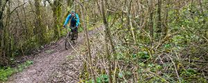
It started innocuously enough, for long enough that I was concerned I had misremembered it. Not to fear though, it casually tips more and more downhill, introducing a tangle of small roots into the mix as it goes. In the summer it has those leaf-dappled shadows that make picking out roots impossible. The flat light of late winter was better for seeing them. Or, at least, seeing how slick they looked. It’s fun to see how much speed you can rack and whether there’s a good line through the roots.
The trail is a diagonal drop from the shoulder of the hill until, out of nowhere, there’s a right-left dogleg accompanied by a sudden narrowing of the trail. It’s quite easy to go straight on into the undergrowth here. In the damp, I was taking no chances. I’m not sure Clark agreed with me. Which is probably why he came around the left-hander trying desperately to clip back in.
Doing the left-right shoogle
Wandering lonely as a cloud
Now we were pointing for home, with only one big climb between us and the car. Thoughts naturally turned to food and the viability of vegan chilli (we both thought it would definitely work). On the map, it was a gentle fire road grind back up to the South Downs ridgeway. In reality, it was a lovely hollow way with old trees flanking both sides and obscuring the pine plantation beyond. Then…
“Clark. Get off your bike.”
“Why?”
Because that,” pointing, “is a field of wild daffodils.”
“That’s amazing.”
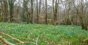
Wild Daffodils
He was right too. From a pleasant but unremarkable coppice, there emerged a carpet of yellow flowers. Impressing a South Downs rider with a carpet of woodland flowers is a challenge: April & May are usually wall-to-wall bluebells. This was a real treat, it was like bluebells, but yellow. It was probably going to be the best nature moment of the day, made better for being completely unexpected. So, we stopped and took a lot of photos that would probably fail to do the scene justice.
It was one of those sights that’s hard to tear yourself from and remember you’re here for a bike ride. So, with heavy hearts (and legs) we got on with the job of reaching the top of the hill.
On the ridgeline again for the first time since this morning, we found ourselves back in the cloud. Brilliant.
I’d planned a small detour on the final leg. I wanted to check out another trail: an extra descent in case clients are still wanting more. Clark was up for it so we peeled off the ridge ready to drop off the scarp face.
Then we stopped.
“Is that enough buzzards for you, Clark?”
“I think so.”
We counted twenty of them, emerging one after the other from the trees the cover the slope, silhouetted against the cloud. Planted to the spot, we watched them soar and climb before sliding off the thermal to wherever buzzards go. The daffodils had been good, but this was gobsmacking.
However, time was passing. Wake up: time to ride. The trail became a wide chalk track that pointed down. It was smooth enough to pick up significant speed. It felt slick enough that your wheels might disappear at any moment, and that you would slide a long way before stopping. Relax and everything will be fine. It was. We reached the junction, only about halfway down, grinning from a descent that had been adrenalin filled far beyond its technicality. What might the second half bring?
Luke, you’ve turned off your targeting computer
Turning the corner onto the second half of the drop, quick reactions stopped me from disappearing into the muddy ruts that suddenly bracketed the trail. Just. Something big had driven this way and carved two trenches that could grace the Death Star (if the Death Star was made of mud), and definitely swallow a bike. In between was a narrow ridge, with an even narrower groove down the middle. Coming off was not an option. The track was still pointing downwards, adding momentum to the equation. It was also meandering adding steering to the mix. Speaking of steering, the groove was the kind of slick mud where the bike goes exactly where it feels like, you just relax and accept it. On several occasions my front wheel was at forty-five degrees and the bike ploughed straight on regardless. Relax, it’ll be fine, a nudge of the hips now and then to keep the bike upright. Remember those mud-riding skills you’ve spent the winter honing. And don’t try dabbing, as the ground is about three feet lower where you want to put your foot.
It was a giggle. For a bit. It seemed to go on a very long time, and I was getting mentally tired from concentrating too hard. Then the track fired us out into a steeply-sloping field at warp speed. Here the wheel-ruts went in all directions and just pointing at the bottom was an option. We both breathed a sigh of relief at the bottom. We also saw the cause of the ruts. Four massive Scottish and Southern Electric off-road flat-bed trucks, there to replace electricity poles. That would explain it.
Not enough to want to do that descent again though.
All that was left was the short climb back to the car. What it lacked in length, it more than made up for in steepness. The chalk track was flat enough, but every pedal stroke was a battle to keep the front wheel down, turn the pedals over and stop the back wheel from spinning out too much. Push hard enough to turn the pedals and the back would spin and stall. There was a delicate balance to be struck in applying just enough power to get the wheels to turn without breaking traction. It’s a while since I’ve felt so pleased for cleaning a climb. That was the glow that took us to the car.
A very short conference resulted in us agreeing that this diversion wasn’t really worth it. That’s what a recce is for: to see if the trails are fun to ride. This one wasn’t, really.
The rest of the ride had been great though, in spite of the unseasonal mulch that had coated everything, including our bikes. Clark pronounced himself a happy man, though a tired one. It’s easy to take a ride for granted once you’ve done it a few times, but this one is a classic for a reason.
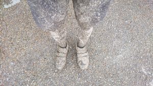
This might take a while to clean off
Now to plot doing it the other way round so we can descend that steep climb…